Boston, July 22, 2008 – The site of the historic Imperial Sugar Company in Sugar Land, Texas, will be transformed from an abandoned mill into one of the country’s best examples of sustainable redevelopment.
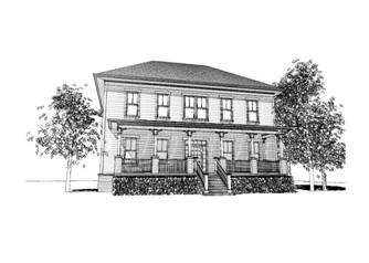
The Imperial Sugar project will be a 650-acre mixed-use community that blends commercial, retail and single-family homes into a walkable, livable, green community. The project is being designed and managed by Nashville-based developer Southern Land Company with the help of Graphisoft Archicad.
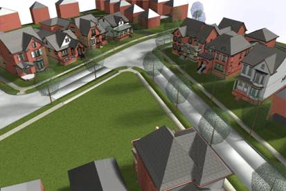 The project recently won a Landmark Award from the Houston Business Journal for the many environmental, regulatory and planning challenges it had to overcome. When complete, the community will include 800 to 1000 new homes while preserving many of the site’s historic elements and natural features, including Imperial’s iconic water tower, massive warehouses and the char house, an eight story structure that produced tons of sugar for consumers the world over. Neighborhood streets will be aligned to maximize views of open spaces and the adjoining Oyster Creek. A trail system will run along its banks. And a central park will provide rest, recreation and outdoor amenities for all residents.
“By combining walkable residential neighborhoods with retail, office space and an entertainment district, the developer hopes to counteract the suburban sprawl that sends residents to stores in their cars, rather than a stroll down the lane,” wrote a Houston Chronicle reporter who recently covered the project.
 According to Geal Golbeck, Project Coordinator for Town Planning and Urban Design Studio at Southern Land Company, using building information modeling (BIM) for the project not only reaped the usual design productivity and collaboration benefits, but also helped with sales and accounting. “Using an Archicad BIM model helped us calculate ‘sellable frontage,’ as we call it, to maximize the sales value of residential and commercial properties,” she said. “Even something as simple as Archicad’s wall tool let us try out different building configurations on the fly and immediately recalculate the value. We’d typically have to waste a half-day or more calculating those changes by hand using AutoCAD.”
The BIM model is also shared between the architects and planners, enabling them to collaborate on streetscapes, for example. The planners and architects use the model to coordinate on how the streetscape will look based on the house height, mass and style. “We can see the street before anything is put in the ground to make sure everyone from Southern Land staff to the community planners and homebuilders are comfortable with the look and feel of the area. We can then use their feedback to see if smaller homes would look better around an open space or bigger homes. Then, once everyone signs off on that streetscape, we can make a fly through or walk through of the area and eventually use it as a marketing tool,” said Golbeck.
Southern Land conducted several charrettes to get community input on the project. With so many stakeholders involved in the planning, Archicad also saved the firm significant time and effort in implementing the frequent changes to the design, Goldbeck said.
Environmental remediation of the property began in March, and construction is expected to begin in early 2009.