BIMmTool

BIMmTool:
The ultimate point cloud solution for Archicad

Download BIMmTool

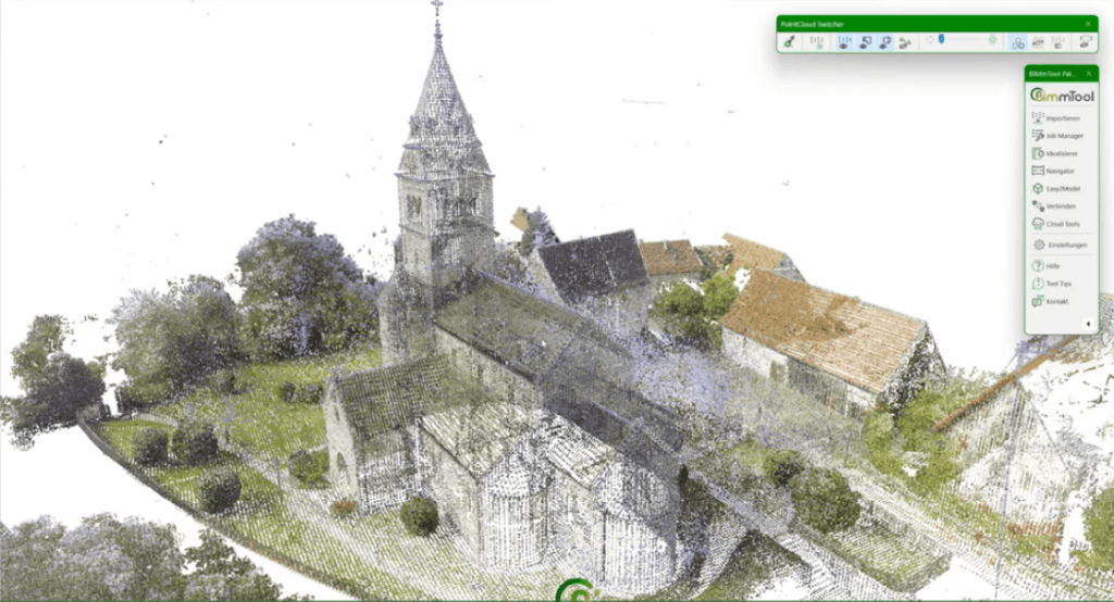
BIMmTool is a fully integrated Archicad add-on for reading, navigating, and generating high-quality BIM models from point clouds. BIMmTool integrates itself into the Archicad interface and ensures a hassle-free workflow in modeling from scans, adopting Archicad’s working method and toolset. Besides the intuitive modeling features, BIMmTool releases the size limitations of importing point clouds and allows displaying them on layouts and printouts. An indispensable tool on macOS and Windows to measure, model, present and control your renovation projects – and much more!

One single Archicad add-on to transform scans into BIM models

BIMmTool is the Archicad Add-on developed especially for modeling from point clouds. Independent from any 3rd party application, it is a professional tool for transforming your scans into a BIM model from the comfort of the Archicad environment.

Importing and managing point clouds

Unlimited scan data

Only your hard disk sets your limits: import any number of scans regardless of these were captured by terrestrial or mobile scanners.

Cluster

BIMmTool assigns scans to stories you link them to. You can also create your own clusters to organize your scan project, for example, in different execution phases.

Adjustable resolution

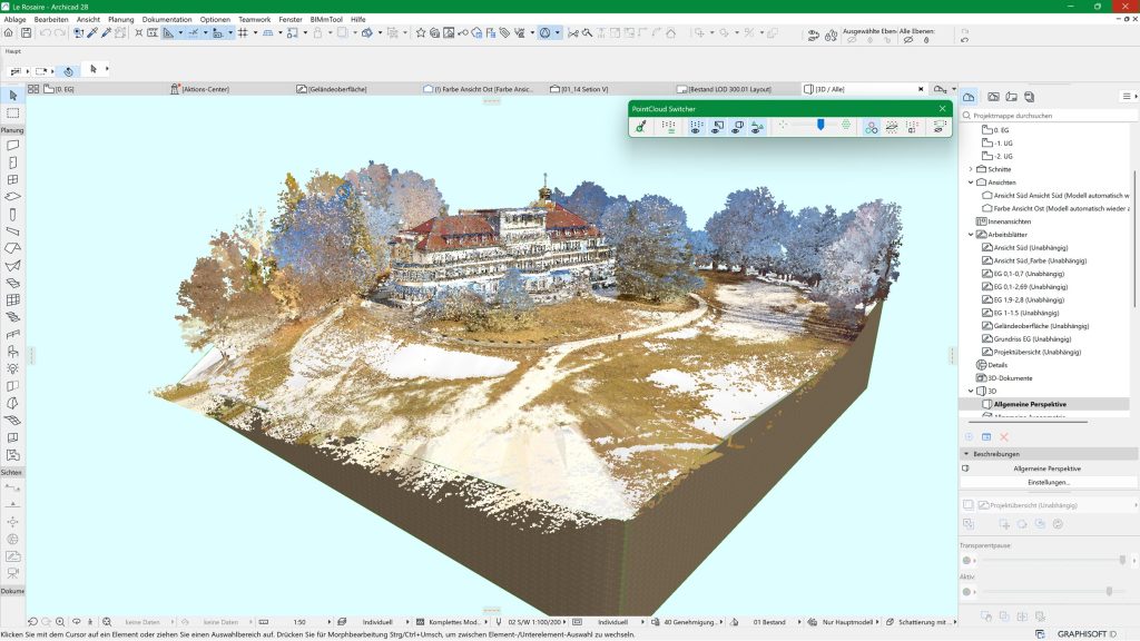
Avoid overloading Archicad: BIMmTool’s model view options assist you in defining the point cloud density to display in Archicad. An appropriate point cloud density optimizes the time needed for navigation in Archicad and does not affect the quality of derivatives.

Teamwork-ready!

Do you share the project with other team members? Say goodbye to the tedious up- and downloads: run the point cloud import by entering the path to your company server or cloud storage (Dropbox, OneDrive, etc.) and allow instant access to other team members.

Navigate and measure with ease

BIMmNavigator

BIMmNavigator is BIMmTool’s integrated viewer, displaying terrestrial scans in a dedicated palette showing the bubble view of structured scans in full resolution. Use your mouse to pan and zoom in all directions exceptionally fluidly.

Show in 3D

The BIMmNavigator “Show in 3D” toggle picks the active scan camera position in the Archicad Perspective window. You can verify the status of the modelled parts by super-positioning with the point cloud. Navigate in the BIMmNavigator: The Archicad 3D window will follow all your movements.

Color / Reflectivity mode

Use the toggle to switch between reflectivity mode and the color scan view, provided the scans were also taken in color. It is efficient in areas where the color scan has overexposed patches.

Easy-to-Measure

BIMmNavigator has a live connection to the BIMmTool palette. Use the “easy-to-measure” functions by clicking on the desired points in the BIMmNavigator to get the length, thickness, and angle dimensions.

70+ Easy2Model
Functions

Modeling with point clouds has never been easier. Use BIMmTool to build your model with the help of the scans. Use the native Archicad tools and combine their features with BIMmTool’s exact point recognition, measure, and model functions to generate the building components with unprecedented productivity.

Orthophotos

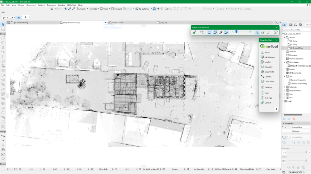
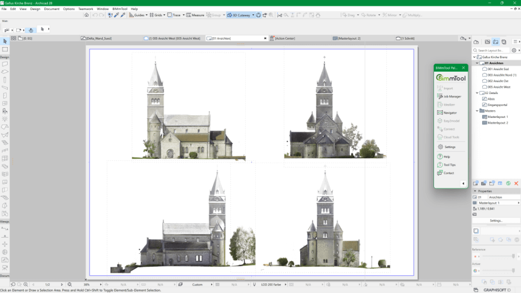
The Orthophoto function generates horizontal and vertical orthophotos from the imported point clouds directly in Archicad. Use it to model from a slice cut out from the point cloud. It does not matter whether the point clouds are structured or unstructured; this feature reduces the calculation time by close to 70 percent compared to earlier methods.

In addition to displaying in color or grayscale, you can also generate high-resolution orthophoto representations, e.g., for monument protection. Once ready, you can import the orthophotos into the desired Archicad window using the Connect menu or create a new worksheet or section/elevation window – and print them!

Delta analyses

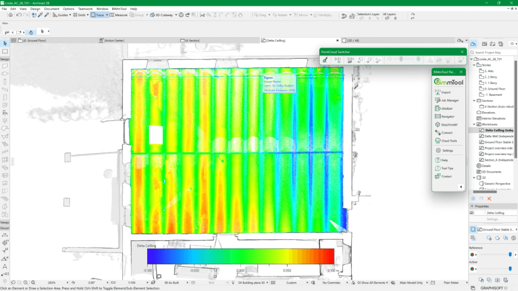
A delta analysis is the colored representation of deviations of the point cloud to a given plane. It is an excellent tool for inspecting existing buildings for deformations and drawing conclusions for modeling. Structural engineers, architects, and craftsmen can use it to compare the actual condition on a construction site with the designed model. The generation and calculation of the delta analysis are identical to the creation of orthophotos and can also be stored at the desired location in Archicad via the Connect menu.

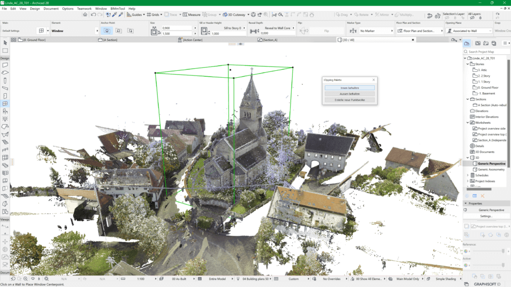
Clipping Box

Use the clipping box to cut and trim point clouds imported via the BIMmTool in Archicad. Drag the clipping box onto the desired area of the point cloud that you want to cut out or trim. Hide or delete the point cloud inside or outside the box. Use it to remove scatter or mirror effects from the point cloud, remove a building in a house row, hide the furnishings in a room, etc. The clipping box also facilitates the creation of a new point cloud, like that of a doorway, a historical window, or a statue. You may also consider using it to show the surroundings of your project.

The new point cloud objects are always calculated in full resolution and can contain further data or parameters. Consequently, you can display these details in a higher resolution, even combine them with the original point cloud.

Create virtual scenes from the selected point cloud segment of an unstructured point cloud. Open your custom virtual panorama in BIMmNavigator and use them to create your models, just as you would with structured point clouds!

Optional IVION
integration

The VLX mobile laser scanner is a device that combines the best of mobile scanning and terrestrial scanning, by surveying up to 20,000 m2 per day, and delivering high distance accuracy and 360° panoramic images in HD with the point cloud. The path is registered and the point clouds are processed in the online software IVION and, if necessary, positioned with georeferenced points.

BIMmTool’s optional IVION integration can access this data and display the panoramas and automatically generated floor plan overviews directly. Click any point in its panoramas, and turn them into a model in Archicad using BIMmTool’s Easy-to-Model functions. Download the point cloud as E57 from IVION and import it via the BIMmTool Pro version to generate orthophotos and delta analyses and place them in Archicad for an even faster and safer workflow.

Minimum system requirements

  • Windows 10, 11 (64-Bit) / macOS 10.14 or newer
  • Processor: 64-bit processor with four or more cores
  • 16 GB RAM
  • At least 50 GB of available hard disk space

More details on optimum configuration >

BIMmTool for universities and students

BIMmTool school and student versions are for institutions, teachers, and students free of charge. Please send your request and proof of enrollment or employment to mail@bimm-solutions.com to verify your status.

Industry background

The construction industry has two main approaches to scanning: Terrestrial scanning and mobile scanning. BIMmTool offers a comprehensive solution for both methods.

Working with mobile devices

Mobile scanners generate unstructured point clouds that contain the information of the captured 3D coordinates, color, and reflectivity. The scanners are easy to handle and allow fast registration and data processing on the building site. Industry-specific drones make the detection from air highly convenient to exteriors. However, mobile scanners are costly and deliver point clouds with lower accuracy and lower point density. The scan resolution depends on the scan speed.
Unstructured point clouds allow the modeling from floor plans and sections. Unstructured point clouds are ideal for less detailed, fast, and large-scale evaluations.

Working with terrestrial devices

The terrestrial scanning method delivers structured point clouds.

  1. Scan positions are registered with each other in a local or georeferenced coordinate system.
  2. The points contain the information of the captured 3D coordinates, color, reflectivity, and scan location from where they were taken.
  3. Depending on the format, the scans also include GPS data and inclinometer data

Terrestrial scans can record in high distance accuracy with a very high dot density. The scans deliver colored HDR quality point cloud panoramas in the desired resolution. It may result in big data and longer scan time, where the scan data needs to be registered. Therefore, it is essential to define the scope of the scan tasks to streamline the capture time and the data size to the actual project needs. Structured point clouds are ideal for detailed evaluations and as-built documentation.